Austria
Hiking trail Obsteig – Simmering alm
-1. Background / History
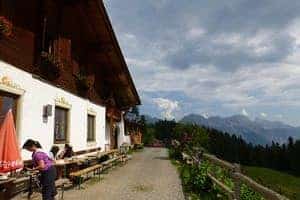
The mountain Simmering (2096 m), the easternmost elevation in the Tschirgant-Simmering, is an advanced peak high above the Inntal. On the Simmering Alm you will find especially in June a true flower parade. Impressive is the excellent view of the Inntal valley and the Mieminger plateau and the mountain ranges of the middle Oberinntal.

View from the Simmering alm
© www.outdooractive.com
The Simmeringalm is open all year round, but in April and November and December only in the weekends and public holidays. The alm is closed on 01.11 and 24./25.12. In advance it is possible to stay overnight.
2. The hiking trail
The trail starts in the village Obsteig. On the way, you have a fantastic view at the Inntal valley. There are plenty of options to enjoy the scenery or take a break at a mountain top or in the huts situated along the trail.
Now the path rises to the mountains Zunderkopf and Simmering (2096m). On the descent, you pass 2 lakes and then you can take a break at the mountain hut Simmering Alm.

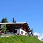
Simmering alm
© www.booking.com
Then follow path no 6 and after 200 meters keep left. Here you go back to the parking lot of the Grünberg ski lift.
2.1 Starting point
The trail starts at Obsteig, near the parking lots in Grünberg.
From Wenns, drive out of the Pitztal valley to Arlz and Imst, then follow the B189 to Tarrenz, Wiesenmühle, Holzleiten and Finsterfrecht, duration 30 minutes.
There is a bus connection from Wenns, via Imst and Nassereith to Obsteig (bus lines 4204,4206 and 4176), duration 2 hours.
2.2 Turn-by-turn directions
Starting point of the trail is the parking lot of the Grünberg skilift near Obsteig. Follow the path into the wood, turn to the left. Now you pass the parking lot of the other trail (see 2.4).
You cross the creek Simmering bach. At the signpost in the GPX on the first map, you can take a look at the Klammle waterfalls (not in the original german description). Back on the trail, you pass the Holzer hütte and you can climb the watchtower Aussichtsturm Grünberg.
At the junction (signpost on the map), turn right and follow road nr. 9 up to the Simmering alm. (When you turn to the left, you can take a break at the Haiminger alm.

Haiminger alm
© www.haiming.at
Follow road nr. 9, uphill to the mountain Zunterkopf, further to the mountain Simmering, this is the highest point of the trail.
On the descent, you reach the Simmering Alm mountain hut. Here you can take a break.

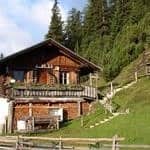
Simmering alm
© www.booking.com
After the hut follow road nr. 6, after 200 meters keep left. Now you return to the Grünberg skilift.
2.3 Duration
For people used to heights it takes x-y hours to reach the destination. For others it will take zz minutes more. When enjoying the scenery more relaxed, taking photos etc. it will take around xx hours. Going down to the village yy goes much faster; around xx hours including zz minutes break for people not used to heights.
2.4 Another trail
The trail starts at the little parking lot before the creek. Up to the Simmering alm the gpx is the same as in the first trail, but the descent follows the serpentine road through the wood. The last part is the same as the start of the trail along the exit to the waterfall, back to the little parking lot.
3. Recommended maps for this region:
Freitag & Berndt – Imst, Landeck, Telfs, Fernpass – WK252
4. Photos
ACTION: UPLOAD PHOTOS
5. Useful links
Add here only usefull links for the visitors of the website. Links to sources used for this post need to go in to the custom field information source.


0 Comments